Monday, January 26, 2009

MS2525 Military Symbology

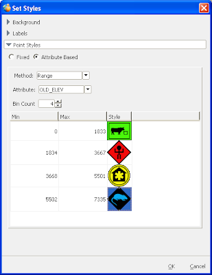
TITAN is fully capable of displaying and even sharing attribute based symbology for point files. To sweeten the pot even further, we now have the ability to easily create complete Order of Battle overlays based on MS2525 symbology within the TITAN Viewer.


See the (very faked up) example below that shows the (very real) utility of MS2525 symbology. No war in Boise though...:)


Friday, January 16, 2009

OpenStreetMap - State of the Map Conference


This is a shout out for the OpenStreetMap conference "The State of the Map," to be held this summer, July 10-12, 2009 in Amsterdam, Netherlands. My favorite stat from an announcement: that OSM is "a worldwide movement of over 80,000 volunteers who are making a new map of the world." That's a lot of community cartographers that make updates to this unique open source map project.

ERDAS has received a good deal of praise for integrating OSM as the default basemap in the TITAN Viewer.

There is a conference schedule available at the State of the Map website. Here is some more information from OSM about the State of the Map conference:

The State of the Map is the conference of OpenStreetMap - the worldwide movement of over 80,000 volunteers who are making a new map of the world.

Over three days in July 2009, the worldwide OpenStreetMap community will be meeting to share ideas and stories as they continue their re-mapping of the world.

Have you ever looked at Google Maps and wondered what's going on in there? Were you shocked by the price of the last map you bought for your TomTom? The answer to all these questions, and more is waiting for you at the State of the Map.

For newcomers to the project, the event is a great opportunity to learn the ins and outs of the leading example of crowd sourcing in the world.

Experienced OSMers will enjoy the opportunity to catch up with old friends, put faces to email addresses and share stories of mapping missions gone awry.

Thursday, January 8, 2009

Historical ads

It's fun to look through old volumes of industry journals that you've kept around for years and years. For one, you marvel at how far things have come. Looking at PE&RS journals all the way back to the mid 80s you see names like Wild, Kern, Kodak and ERDAS of course! Paul at the Field Guide scanned a few of the very first ERDAS ads and now has a history of ERDAS ads running down the right column of the blog.

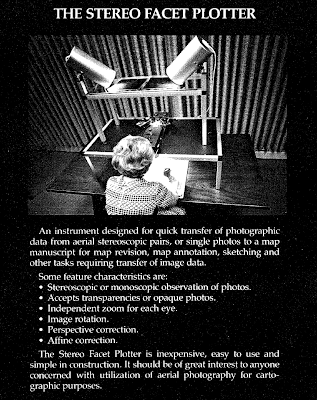
Here's a great old ad featuring a Stereo Facet Plotter from OMI (Otto Meccanica Italiana) from 1985. Wow those are some lights!!

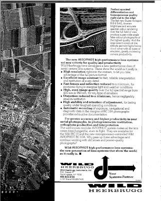
Here's one of our own from Wild, also from 1985. (Wild-Leitz merged with Cambridge Instruments to form Leica back in 1990):

If you're into old photogrammetry tools Ryan was just at Leica Geosystems headquarters in Heerbrugg last week and took some pictures.

Thursday, December 18, 2008

ERDAS TITAN Client Update: includes faster vector rendering!

Today, all ERDAS TITAN Clients participating on the public TITAN Network will automatically update to version 9.3.2d. This update includes fixes for:

* KML optimization that accelerates rendering of vectors with many features or vertices
* Fix for KML shadowing properties

The auto-update will occur the next time you log into the public ERDAS TITAN Network with your TITAN Client.

Tuesday, December 16, 2008

OpenStreetMap and ERDAS TITAN for Broad Global Basemap Coverage

I'm buzzing a lot about incorporating OpenStreetMap (OSM) as the default basemap in the TITAN Viewer because we are especially excited to have the opportunity to make available to TITAN users this unique, free source of data contributed to by "community cartographers" around the globe.


The blogosphere is rich these days with comparisons hailing the OSM global dataset as 'better than' that of other corporate competitors in many areas. SlashGeo points to some comparisons here. This is so interesting since contributions to OSM are made by a volunteer force; no corporate machine feeds this source!

In a November post Ogle Earth blog zooms in on Baghdad to show OSM having the best coverage and "going where big corporate mapping datasets fear to tread." In Baghdad all other maps but OSM are sparse at best, as illustrated in this post.

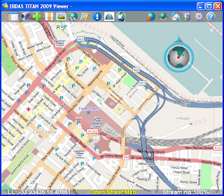
ERDAS TITAN 2009 Now Supports OpenStreetMap press release was issued today. Below is a screenshot of OSM in the TITAN Viewer.

Monday, December 15, 2008

Use Your Own Data as Basemaps and Terrain in the TITAN Viewer

Ryan at The Fiducial Mark has been busy hosting webinars such as "3D City Construction Workflows: From Collection to Presentation" and also making interesting posts showing how to make the most out of the ERDAS TITAN Viewer for modeling 3D urban spaces. In two separate posts he describes how you can use your own personal, local data as either 1. basemap or 2. terrain in the TITAN Viewer.


Most virtual worlds have pre-cooked imagery that they serve up as their "skin of the earth" basemap. But what if I want to define my own default imagery, just for my own personal use?

Here Ryan walks easily step by step to show you how to turn your own datasets into basemaps in the TITAN Viewer. He added a picture displaying results:


2. Ryan deals in photogrammetry and highly accurate data. In another post he describes how terrain available in many virtual globes are too coarse and inaccurate to properly display 3D buildings extracted from photogrammetric processes. In a post on 3D Buildings and Terrain in Virtual Worlds Ryan points out that the latest release of ERDAS TITAN has a good technique for sorting out this problem by allowing you to specify your own local raster datasets as terrain layers:

In this case I processed my own digitial orthomosaic along with a terrain layer during the photogrammetric processing part of the project. I added the digital elevation models as layer, right-clicked on it and chose the "use as terrain" option....The result is that the (3D KML) buildings sit perfectly on top of the terrain.
Here's a screenshot of floating buildings:


And here's a screenshot in the TITAN Viewer with an accurate, locally added terrain source and the buildings sitting properly on the ground:

Thanks for the How-To along with the posts Ryan!

Thursday, December 4, 2008

ERDAS TITAN Client 9.3.2c Released!

We have made some exciting changes to the ERDAS TITAN Client! New features in ERDAS TITAN Client 9.3.2c include:
  • OpenStreetMap is the default basemap. This collaborative, free global map project is now available as the default basemap option in the TITAN Viewer. For more information on OpenStreetMap, please visit http://www.openstreetmap.org/


  • Multi-Screen Support allows you to span one TITAN Viewer display across multiple PCs/ screens, creating the illusion that the numerous displays are one contiguous display.

TITAN spans multiple screens at Arizona
State University's Decision Theater.

  • Attribute based symbology for point vectors in the TITAN Viewer and a default DHS symbol set.

  • Locally add multiple DEMs as terrain sources in the TITAN Viewer.

To see a list of all the enhancements, please see ERDAS TITAN Client Update 1 – Version 9.3.2c What’s New.