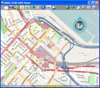
I'm buzzing a lot about incorporating OpenStreetMap (OSM) as the default basemap in the TITAN Viewer because we are especially excited to have the opportunity to make available to TITAN users this unique, free source of data contributed to by "community cartographers" around the globe.
The blogosphere is rich these days with comparisons hailing the OSM global dataset as 'better than' that of other corporate competitors in many areas. SlashGeo points to some comparisons here. This is so interesting since contributions to OSM are made by a volunteer force; no corporate machine feeds this source!
In a November post Ogle Earth blog zooms in on Baghdad to show OSM having the best coverage and "going where big corporate mapping datasets fear to tread." In Baghdad all other maps but OSM are sparse at best, as illustrated in this post.
ERDAS TITAN 2009 Now Supports OpenStreetMap press release was issued today. Below is a screenshot of OSM in the TITAN Viewer.


No comments:
Post a Comment